According to the NWS, the current outdoor temperature is 74° under cloudy skies. My DTWS also shows 74º on both the front porch and the deck. Also according to the NWS, winds of 25 mph make it feel like 74°. I guess that the current temperature is high enough that the winds make no difference.
The forecast from the NWS calls for today's high to be 76º under skies that will become more cloudy as the day wears on with a relative humidity index of 84%. That 76º mark is a full 11º cooler than yesterday's high temperature. We still don't have A/C, but we are hopeful that someone will give us an estimate as we have a confirmed appointment with a contractor for next Wednesday, the 17th.
Currently, no rai is falling. However, as the day unfolds, the chance for precipitation and/or T-storms increases from a 20% chance @ 6:00 a.m. this morning up to 80% this afternoon.
Given what the temperature was like yesterday, the NWS forecast for an overnight low tonight of 57º is amazing.
According to my DTWS, the barometric pressure is 28.86", while the NWS is reporting 29.44". Generally, those readings indicate foul weather and the NWS is forecasting those storms/T-storms for later today.
The sun will rise this morning @ 6:05 a.m. and it will set later @ 9:24 p.m.
A Gale Warning remains in effect until 2:00 a.m. Thursday morning. South winds of 20 to 30 knots with gusts up to 40 knots and waves 5 to 8 feet are expected. Waves will be building to 5 to 8 feet from St Joseph to Manistee. Strong winds will cause hazardous waves that could capsize or damage vessels and reduce visibility. Mariners should alter plans to avoid these hazardous conditions. Remain in port, seek safe harbor, alter course, and/or secure the vessel for severe conditions.
A Wind Advisory remains in effect until 8:00 a.m. today. South winds of 15 to 25 mph with gusts up to 45 mph are expected for Mason, Oceana, Muskegon, and Ottawa counties. Gusty winds could blow around unsecured objects. Tree limbs could be blown down and a few power outages may result.
A Beach Hazard Statement also remains in effect through Thursday evening. High wave action, strong currents, and dangerous swimming conditions are expected. Piers may be heavily swamped by waves in Mason, Oceana, Ottawa, Allegan, Van Buren, and Muskegon counties. Strong currents can pull swimmers into deeper water and high waves can sweep people off piers. Swimmers should remain out of the water to avoid hazardous swimming conditions and should not venture out on piers.
I got my new glasses yesterday and they are great! The fit is excellent, the correction is perfect, and they look great too. I highly recommend Eye Care One in Spring Lake!
Since we were in Spring Lake, we took two side-trips. The first was a stop at the Spring Lake cemetery. while the second took us to nearby Fruitport. There, we visited their local cemetery. For some, that may seem like an odd, maybe even macabre place to visit, but the "residents" are quiet and the markers, the trees, and other fauna are very photogenic. So, I took some pix that caught my eye.
 |
| The opposite side is a "Smiley Face." |
 |
| We wondered why they hadn't put their name in code. |
 |
| Wooded and peaceful. |
 |
| Shadows and light, a nice contrast. |
 |
| Part of the cemetery mausoleum built-in 1960. |
 |
| A long-distance shot of the mausoleum. |
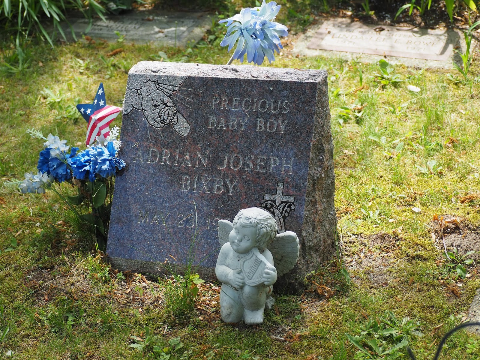 |
| Part of the section set aside for children. |
 |
| A long view of the children's section. So sad and yet, so peaceful too. |
 | ||||||||||||||||||||||||||||||||||||||||
| I dunno, just caught my eye. |
 |
| Water levels remain very high in the local lakes and waterways. |
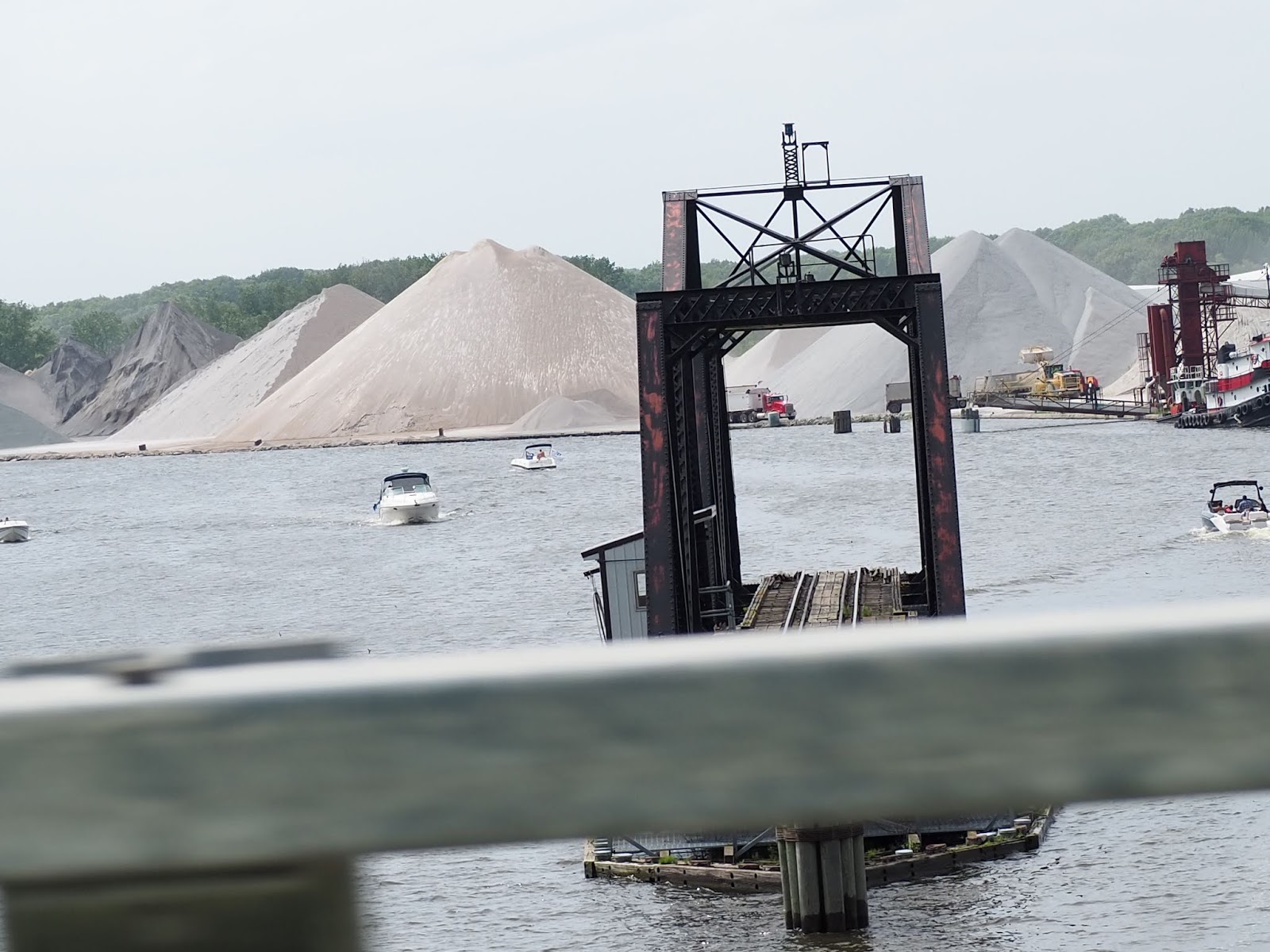 |
| Our fully open swinging bridge over the Grand River with the Verplank Dock in the background |
 |
| Mary's roses are beginning to bloom in the vast gardens. |
Today, we have very little planned. A crossword to solve, some indoor chores to do, some reading to pursue and some music to be played. But, no watering! Oh, more Outlander to be watched too. Ciao.
No comments:
Post a Comment
Note: Only a member of this blog may post a comment.